8/28/2012

Outdoor Week Ending 8/26/12

Run  Rclimb  Long  Lclimb  Hike  Hclimb  OnFeet
6:49   1960    2:33    800   10:36    3945    17:25

Good week, feeling pretty strong, but longing for cooler temps soon!

Some Pix -- Giant rock out on the breakneck ridge trail
 Third reservoir, just before I spooked 3 wild turkey coming around another big rock
 Despite lots of thunderstorms, water levels are low this year
 Looking east from Harriman park
 Zoom 20x to see a little bit of the Hudson River about 10 miles away
 This guy I'd seen before, out on the Suffern-Bear Mountain trail
 This time a female with a pretty golden color -- would have run into striking range but saw her...

I saw three timber rattlesnakes this week. The Ramapo highlands are loaded with them. Just makes you run more aware. I clap my hands sometimes when the trail has underbrush at the sides. Can't run with headphones really or you miss all those little sounds:  chipmunks, skenks, snakes...

8/19/2012

Outdoor Week Ending 8/19/12

Feeling good this week. After the big run Thursday from Woodland Valley, Friday I ran a little but the left knee was slightly sore that night, so I was going to just hike Saturday, but took the day off instead. Feeling pretty good today out there the better part of 4 hours again. Did lots of very technical trails today and only felt a little sluggish.
 
Run  Rclimb  Long  Lclimb  Hike  Hclimb  OnFeet
7:54   2655    2:53    875   10:16   7055    18:10

13-Aug    run    0:53    400    3.5    south harriman
13-Aug    hike    2:17    700    2.5    south harriman
14-Aug    run    1:11    600    3.5    ram park
14-Aug    hike    1:44    700    3    ram park
15-Aug    run    0:27    50    2.5    south harriman
15-Aug    hike    1:05    480    2.5    south harriman
16-Aug    run    2:53    875    5    Slide Loop
16-Aug    hike    2:55    4225    5    Slide Loop
17-Aug    run    0:27    30    2    ram park
17-Aug    hike    0:38    350    2    ram park
18-Aug    off                   
19-Aug    run    2:03    700    3.5    south harriman
19-Aug    hike    1:37    600    3.5    south harriman

Goals:
I'm still feeling like I will probably run the Vermont 50k (end of September) and maybe the Maine Bradbury SP 50k as well later in October. But instead of doing races, I might just do a big run every 3rd week like I've been doing all year, somewhere out on some cool trails. I feel like I'm making progress in my running and hiking and it's taking me to a new level, so I might just continue that. I'll decide soon.


8/17/2012

Catskills: Slide Mountain Loop

Just another run-hike up in the Catskills. Lots of fun. I parked in Woodland Valley, then headed up Wittenburg Mountain, then looping clockwise over Cornell and Slide, the high point in the Catskills, then around on the road a little to climb up onto a slight detour at Giant Ledge, backtracking and running back down into Woodland Valley. Some stats for the outing:

About 7 hours total time
Overall 5:37 moving time at heart rate 140 (73% max), 5100' climb/descent, about 17.5 miles
Hiking:    2:55, 4225' climb, 125' descent, HR 139, about 5.9 miles
Running:  2:53, 875' climb, 4925' descent, HR 141, about 11.6 miles
Basically most of it is very technical, and I ran where I could. Most of the uphills were too steep to run. Interesting (to me) how similar the heart rates are.

Gear: I chose the Saucony Peregrines, a lighter shoe, over the Montrails, and it worked out really good. My feet were comfortable the whole time and they handled the miles of rubble fine. I'd brought a very thin shell top, my headlamp, fire starting stuff, about 1000 Cal of food, and a little over a gallon of water. But I ran out of water with about 2 miles to go, and I'd run out of food before that. All the springs were dry on the main loop. Good thing it wasn't a hot day!
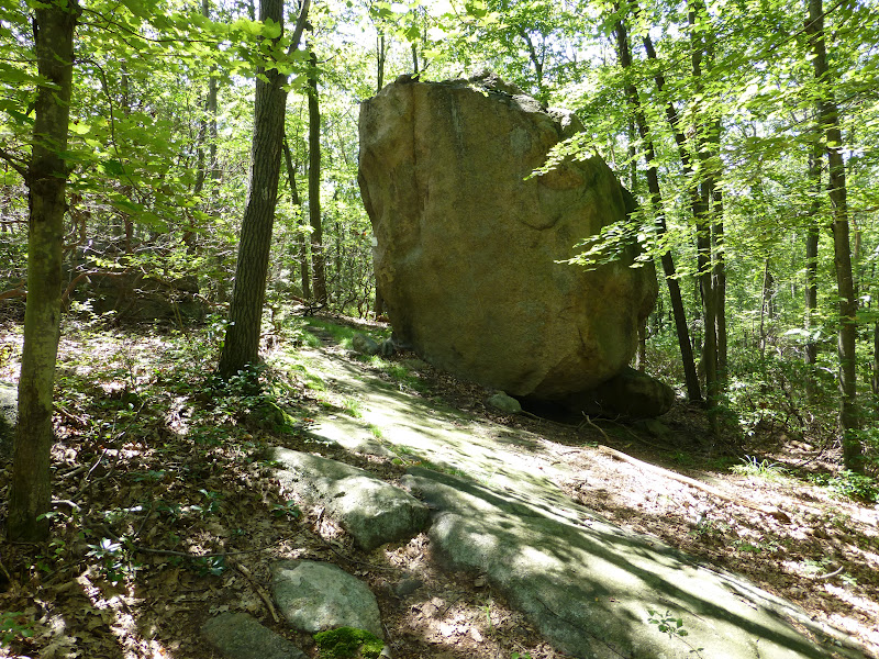


Trail to Wittenburg


Somewhere in here, about a third of the way up Wittenburg, I passed a group of a dozen mid-teenage backpackers. I didn't see anybody else until I got the col between Cornell and Slide.

 Views from Wittenburg, South
East, the Ashoken Res, at least half a vertical mile below, very low water, huge sandbars visible
 North, the Devil's path range

 North, looking back at Wittenburg from Cornell
 Camping spot atop Cornell
 West from Cornell, Slide Mountain looming
South, a glimpse of Rocky and Table mountains

In the col before Slide, I saw a couple of backpackers looking at the camping spots there (some nice ones). Then I met a solo backpacker heading down the steep side of Slide. He was looking for water but said the spring higher up was dry. The trail was really wet after lots of thunderstorms in this area (rocks really slippery, wet feet a bit) but the rains have been quick so we're starting to get drought conditions in some areas even though everything is lush on the surface. I told the guy that he might have to hunt south off the col for streams that become the headwaters of the Neversink river (east branch). I did that once when overnight-ing off-trail, just keep going downhill in the deepest gully you can find until water is flowing. Costly in terms of contours though, and not guaranteed.

The rubble trail down from Cornell
Lots of very tough ledges between Cornell and Slide, many being more dangerous than anything on the Escarpment trail
 The steep side of Slide has some small cliffs you have to climb, and a bunch of ladders
East, Wittenburg and Cornell from the slopes of Slide

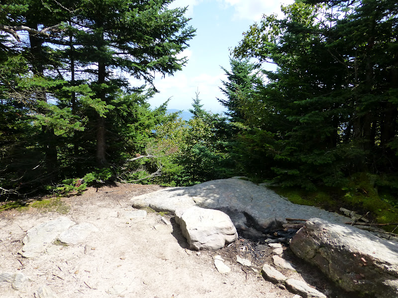
 Top of Slide, All the good views are a bit down the hill

Up on top of Slide I started to see more people, four people on top already when I got there, then about half a dozen more on the descent to the main Slide parking area.

Heading down Slide to the west there is one great view to the north, this one looks down at Giant Ledge, where I'm headed next, and Panther mountain beyond

Giant Ledge doesn't look like much from here, but it probably has the best easy-hike (from rt 47) views in the Catskills
North still, Devil's path range again
Heading west, the trail on top of Slide is fairly runnable at first
 Then it descends into worse and worse rubble, quite challenging stuff lower down
 Midway down, what does that look like 15%? Nasty rubble
 Camera held level, looking down the trail
 Same, looking up
 9.7 miles to go.
 Had to do a mile (?) on the road

 The Winnisook lodge private club in the saddle of the hill at 2700'


Just past the lake, where the road heads downhill is the easement, but the marked trail follows the road. Of course I took the easement, to save a whole bunch of contour lines.


Looks like the Winnisook lodge wanted a nice level trail over to Giant Ledge, but 95% of it is on public land, so I guess the compromise was it's fine for the public to use it (hence the easement over the short bit at the start), but in every other way discourage the public from using it, making the marked trail detour 700 vertical feet down to the road and put up sticks and stuff to discourage people. 

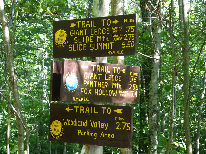
 About to detour 1.5 miles for the views at Giant Ledge
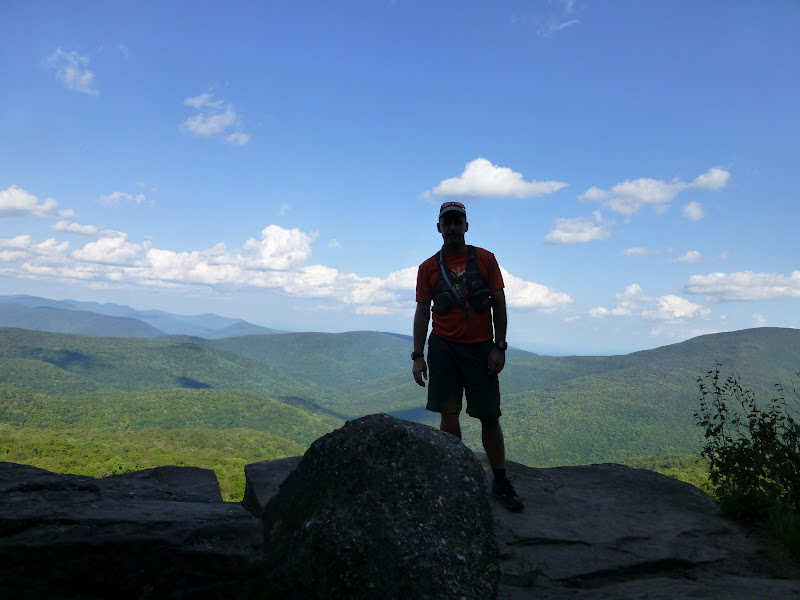
 Which are here: North
 Southeast, the ridge around the Woodland valley basin I climbed and hiked/ran around


The trail back down to Woodland valley is full of rubble and is very technical because of that, but this photo doesn't really show it, oh well.


Halfway down the 2.7 miles to Woodland valley I saw the same group of teenagers I'd seen 6 hours earlier, now going uphill when I was coming down. They were kind of shocked I'd come all the way around when they'd only gone about 2 1/2 miles, and that I was running down the trail, which was full of nasty rubble (basically almost no dirt and several levels of smaller unstable rocks). I thought at the time: backpacking is fun sometimes but I'm happy to be heading home. 

After I saw those disheartened kids (they had a good 1200' to climb, preferably before dark and it was already almost 6pm, that side of the valley already in shadow), the one group higher up waiting for 3 girls dragging far behind -- I was happily scooting down the rocks as efficiently as I could, and then the trail suddenly turns left at the bottom of a huge reentrant, and starts going straight back up the mountain at a 40 to 45 degree slope, the trail markers stretching on up the hill out of sight. Ok I'm thinking, I was having fun cruising, what the hell?! That got me to get the map out, so checking, I see the big square corner of private land jutting deep into the park from the valley road. Got it. But, you know, I'd been out of water for 45 minutes by then, with still a tough 1.x to go, so I didn't relish climbing those 250 vertical feet just then, but that's the trail. Somehow I'd forgotten that little bit after I last did this stretch of trail almost 20 years ago. Oh I was going the other way, that's why.

Done

I changed the total length estimate to 17.5 miles. The 16 miles the trail map specifies for the whole loop, + the 1.5 mile GL detour, - 0.5 the savings of the easement, + 0.5, the little bit running down the wrong trail (cruising having a good time); well someone had stolen the trail markers at the turn.

Not that miles really matter much on these kind of trails. I just look at the map and based on experience and some knowledge of the terrain make an educated guess on how long the whole thing will take me. This time I had guessed I could do it in about 5 hours moving time, running and hiking. I always like to stop for 5 minutes here, 10 minutes there, and always longer at some point. So the overall time was 7 hours, more important to me is moving time. So this time was 5:47 moving time, about evenly divided between hiking and running. No leisurely hiking this time, just pushing steadily up 4k+ of climb. Not having done some of these trails in 20 years I'd forgotten how technical the footing is and the rocks were really wet in many places, so I wasn't taking chances.

I never ran this loop before, but hiked it 19 years ago, and have run various little parts of it since then. "Running" this loop intimidated me a little in the past. I would do pretty big stuff (for me) in the Catskills, like a 27 mile loop on all new (but easier) trails to me over near Mongaup pond, but I didn't think of running this Slide loop until a few days before. I think the difference now is how much more hiking I've been doing this year as I've extended my outings that used to be pretty much all trail runs. Now I go out with the intent to hike part of the time and run part of the time, and that gives me confidence to not only handle a bit longer stuff on a daily basis, but a go-as-you-please approach makes the outing more enjoyable. In this case though I did run everything I could; the terrain dictated that I hike fully half of it time-wise, one third by mileage.

8/12/2012

Outdoor Week Ending 8/12/12

Fine summer weather meant more hiking this week. Two weeks after the Escarpment trail run I feel pretty good, getting out for a 4:42 run-hike today. We'll see what happens, but the plan is to try to get at least 20 hours on my feet for a few weeks, about 7 hours of that running, the rest hiking.

Run Rclimb Long Lclimb Hike Hclimb OnFeet
7:23  2250   2:07   700   11:25 4080   18:48

Date Type Time Climb Effort (HR) Description
6-Aug run 1:23 700 3.5 ram park
6-Aug hike 1:30 500 3 ram park
7-Aug run 0:57 250 4 stony brook
7-Aug hike 1:18 300 3 stony brook
8-Aug hike 1:21 520 2 stony brook
8-Aug run 0:29 0 2 stony brook
9-Aug run 0:47 50 2.5 ram park
9-Aug hike 1:44 850 3 ram park
10-Aug run 0:53 420 7.5 ram park
11-Aug run 0:47 200 3 stony brook
11-Aug hike 2:57 800 2.5 stony brook
12-Aug run 2:07 630 4 142 stony brook
12-Aug hike 2:35 1110 4 123 stony brook

Goals:
Continue to enjoy the trails as much as possible
Vermont 50 Km run September 29th
Big Brad 50 km (Bradbury Mtn SP Maine) Oct 20th (considering)

8/09/2012

Some Recent Videos

Deer in Harriman Park...


Some Trail Running...


Why I Run...

Now I run because being in shape as a runner gives me a physical freedom that keeps me young and able to keep exploring and going places, keep moving where and when I want, in the most primitive form of movement. As an avid trail runner and hiker, I can keep exploring and enjoying the outdoors just like I did when I was a kid, but on a grander scale. It's all relative; there are many people who can go farther and faster than me, but I enjoy the freedom running provides.

In the past there were lots of other reasons to run as well -- losing weight, addiction to running, racing, "my time", escape from problems, thinking time, moving meditation, and more. And there were different kinds of running: soccer, sprinting, orienteering, road racing, trail running, and some ultrarunning.

Now I love the mesmerizing focus and controlled chaos of technical trail running, but I've also been extending my time out there with hiking. More and more I'm beginning to see less difference between walking, hiking and running, though I think most runners see clearer lines of difference. It's just a question of speed and effort, and there are times when fast is great, just as there are times when slow is wonderful, more thoughtful, more perceptive to surroundings, as life in the past meant knowing everything about your surroundings, as life depended on that. But the flow of trail running is a thing of art and beauty.

8/07/2012

Gear Review: Ultimate Direction Diablo hydration vest

This is my first vest-style hydration pack. I chose this model because:

- I like Ultimate Direction products 
- it can carry a lot of water if necessary
- it has a good deal of room for gear while still being rather minimal
- it has a built-in bottle holder

On the front you find two large pockets, plenty of room for a point-and-shoot camera on one side and room for whatever else on the other side (for me salts, chapstick and extra food). Above the zip pockets there are generous mesh holders that can carry 3-4 GUs each or two bars each. Good handy space.


In profile you see the built in bottle holder and outside mesh pocket, holding two 24 oz Camelbak bottles. The Diablo comes with an Ultimate Direction 20 oz bottle, but the slightly bigger bottle fits more snugly, while of course holding more liquid.


The mesh pocket is big enough to hold a bottle or a light rain jacket. At the top you see there is a small zippered pocket that is big enough to hold a decent-sized wallet and a cellphone.


This side pocket has a little interior pocket that could hold keys or a small phone. I really like having room to put everything in my pack on a day-to-day basis, my whole key set, my full wallet, my phone, my camera. I like having all that with me instead of leaving some of it in the car. This pack makes that easy.

*Note:  flaws should be pointed out -- the side pocket zipper zips upward, leaving it vulnerable to getting caught on a branch or something and zipped open by accident, much less likely than if it zipped downward.


The main pocket has a hydration bladder sleeve and comes with a 96 oz bladder (not shown). But for me, I really like using bottles and not a bladder on a daily basis for lots of reasons, but mainly they're much easier to clean. This pack can hold a couple of liter size bottles easily, with a little extra room next to the bottles and above them there's room for a big lunch.


 I've tested the pack using two full liter bottles in the main compartment, with one 24 oz bottle in the bottle holder. The ride on my back and shoulders was probably a little heavier and with slightly more bounce than the hydration bladder would have caused, but it wasn't bad at all. Add another 24 oz handheld that you can stash in the outside pocket later and you can have 110 ounces of liquid quite easily. 


That's what I really like about this pack, the ability to carry lots of water, or water and a good amount of gear for such a small pack. Using the 96 oz hydration bladder, you could easily add the two 24 ounce bottles for a total capacity of 144 ounces, or one gallon and one pint. Of course with all that weight it wouldn't ride as well, but you could always carry one or both of the bottles as handhelds until you drink them, and then stash the bottles on the pack. This pack is versatile and has the most capacity I've seen of any currently available hydration vest. It rides so well I will probably use it nearly every day from now on.

*Update:  After using the Diablo vest daily for over a week straight, I have some circular scars on both sides of my shoulders near my neck, the result of chafing. To me it's not a big deal and it doesn't hurt, and I still love the vest overall. But carrying 6-8 pounds every day does make it somewhat heavy on the shoulders. Like many other pieces of gear, there are pluses and minuses. I will just add some extra padding if necessary.

*Update after 6 months of use:  The Diablo has become my daily pack, and I've worn it almost every day since last summer. I always have what I need, from sufficient water in summer, to some water and an extra layer or two in winter. I do wish they had a bigger version because sometimes I can't carry as much as I want, but I've gotten by quite well, and the ride on my body of the vest style has been great. 

When carrying lots of water it digs in a little too much when running, but it's still been my best and most comfortable option. I discovered that I can use a strap to link one of my Ultimate Direction Solitaire packs onto the bottom of the Diablo, to easily carry another liter of water with more support and stability, because the Solitaire has adds a waist belt. I really love the Diablo and highly recommend it, and using bottles instead of a bladder on a daily basis is the only way to go. 

A bigger version with 50% more carrying capacity, based on the vest style, but with a waist strap, would be wonderful to have for winter. And generally, they could make the style much sleeker and they could make the pack portion wider to spread it over the back laterally, but the functionality of this pack cannot be beat in my opinion. 6 months of use and still loving it.