9/30/2012
Outdoor Week Ending 9/30/12
A little over 12 hours about 8k feet of climb this week, mixed trail
running and hiking.

9/25/2012
Some Pix from last week
The Ramapo highlands of south Harriman


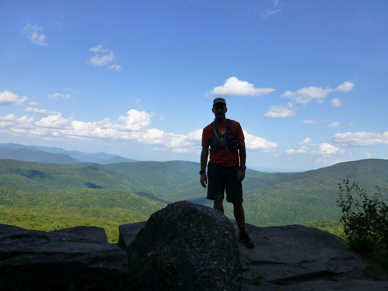
 View from Ramapo Torne
 My nemesis, the NYS Thruway (exit 15b)
 Freedom tower @ 20 miles
 Empire state
 Ramapo Torne from 2 miles
 Praying Mantis -- it turned it's head toward me

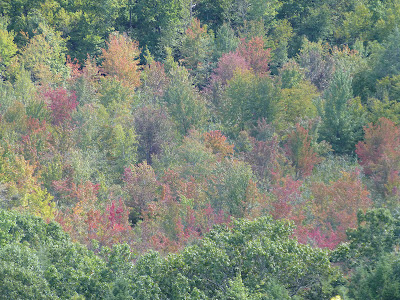
 Fall colors just starting


Outdoor Week Ending 9/23/12
Though we had some rain, the weather this week was outstanding, with somewhat cooler early fall temps ending the week. This was probably my biggest summer ever in terms of getting outdoors for trail running and hiking, and this was my 2nd 18 hour week in recent months. Though I've been in sharper condition for trail racing, overall my combined running and hiking fitness right now is very good, and I felt strong enough to go very hard at the end of my 2nd 3+ hour run on consecutive days.
I've been wearing the Garmin Forerunner 305 for most of September, but it's too time-consuming to parse the data every week. Since this is a bigger week time-wise I wanted to look at the data. Basically I try to press the lap button every time I switch to a run from a hike or a hike from a run. Since I normally start out every outing hiking easily to warm up, that makes every odd lap hiking and every even lap running. Of course I screw up the lap sometimes, so I have to look at the data. For me it's interesting this time because I've just been doing whatever I feel like at the time, running or hiking. Here's the data:
Hike Run Total
Time 10:57 7:16 18:13 hh:mm
Dist 28.7 33.1 61.8 miles
Climb 7,998 2,168 10,166 feet (looks like I hiked up most of the hills)
Desc 2,955 7,388 10,345 feet (and mostly ran down)
HRavg 120.9 140.7 128.9 bpm
Speed 2.59 4.46 3.44 MPH
All my runs were on fairly slow technical rocky trails, because that's the kind of terrain I like.
Now some fun with numbers. If I was running on flat ground with good footing instead of on hilly rocky technical ground, how many miles would I have run?
The hiking effort of HRavg 120.9 for 10:57, using the MPH/HR table below,
yields 4.54 MPH, for 49.7 virtual miles.
But since I was really hiking during that time, if I walked instead of running, the fastest I would walk is 4 MPH, so that gives 43.8 virtual miles instead.
For the running effort, at HRavg of 140.7 for 7:16 yields 6.75 MPH and 49 miles.
So that makes my virtual summary for the Week:
If Walk & Run 92.8 Miles
If All Running 98.8 Miles
Basically the trails I run -- the technical terrain and climb mean almost 50% less distance is covered for the same heart rate effort, but though that's just fun with numbers, it illustrates why miles
don't tell the story with trail running.
For me it is what it is, and time and effort are all that matter. Terrain and climb for specificity
also matter. Miles alone mean very little, so I basically ignore miles. But the truth is I'm not conditioned to run 98 miles a week, or even 92 miles. Flat terrain running causes overuse injuries, at least for me. Mixing running and hiking is the best, for me.
MPH/HR Table
Estimated Heart Rate at Given Speeds, on flat ground with moderate temps, based on past data points from flat runs:
Running
7 150.00
6 137.50
5 125.00
4 117.50
Walking
4 115.00
3 102.50
2 90.00
I've been wearing the Garmin Forerunner 305 for most of September, but it's too time-consuming to parse the data every week. Since this is a bigger week time-wise I wanted to look at the data. Basically I try to press the lap button every time I switch to a run from a hike or a hike from a run. Since I normally start out every outing hiking easily to warm up, that makes every odd lap hiking and every even lap running. Of course I screw up the lap sometimes, so I have to look at the data. For me it's interesting this time because I've just been doing whatever I feel like at the time, running or hiking. Here's the data:
Hike Run Total
Time 10:57 7:16 18:13 hh:mm
Dist 28.7 33.1 61.8 miles
Climb 7,998 2,168 10,166 feet (looks like I hiked up most of the hills)
Desc 2,955 7,388 10,345 feet (and mostly ran down)
HRavg 120.9 140.7 128.9 bpm
Speed 2.59 4.46 3.44 MPH
All my runs were on fairly slow technical rocky trails, because that's the kind of terrain I like.
Now some fun with numbers. If I was running on flat ground with good footing instead of on hilly rocky technical ground, how many miles would I have run?
The hiking effort of HRavg 120.9 for 10:57, using the MPH/HR table below,
yields 4.54 MPH, for 49.7 virtual miles.
But since I was really hiking during that time, if I walked instead of running, the fastest I would walk is 4 MPH, so that gives 43.8 virtual miles instead.
For the running effort, at HRavg of 140.7 for 7:16 yields 6.75 MPH and 49 miles.
So that makes my virtual summary for the Week:
If Walk & Run 92.8 Miles
If All Running 98.8 Miles
Basically the trails I run -- the technical terrain and climb mean almost 50% less distance is covered for the same heart rate effort, but though that's just fun with numbers, it illustrates why miles
don't tell the story with trail running.
For me it is what it is, and time and effort are all that matter. Terrain and climb for specificity
also matter. Miles alone mean very little, so I basically ignore miles. But the truth is I'm not conditioned to run 98 miles a week, or even 92 miles. Flat terrain running causes overuse injuries, at least for me. Mixing running and hiking is the best, for me.
MPH/HR Table
Estimated Heart Rate at Given Speeds, on flat ground with moderate temps, based on past data points from flat runs:
Running
7 150.00
6 137.50
5 125.00
4 117.50
Walking
4 115.00
3 102.50
2 90.00
9/16/2012
Outdoor Week Ending 9/16/12
6 days mixed hiking and trail running
14:27 time, 8450' climb, 127 average heart rate
A good week, featuring some faster running, and some very slow easy hiking leading an old lost dog back to the trail head.
I like heart rate as a measure. In cycling they use Watts, but for running it's the closest thing we have to tracking effort. You can use % of max, % of heart rate reserve, % over resting, or % over normal activity. If my normal (sedentary worker) activity heart rate is 70, then 127 is 81% more than that. I estimate my HR max is around 191, so 127 is 67% of max. When I was running only and not hiking much, my average HR for the week was probably in the low to mid 70s percent, so not much different when you add in a bunch of vigorous hiking and even some very casual hiking. A cursory review of the data suggest that my hiking HR is mostly in the range 120 to 130, whereas my trail running HR is in the range 135 to 145.
Fall Goal:
I changed my mind! I signed up for a 50 km race on October 20th, the Big Brad 50 km in Pownal, ME. This race is on technical trails, so the time will be slow, but as of now I'm planning to run it hard. We'll see.
14:27 time, 8450' climb, 127 average heart rate
A good week, featuring some faster running, and some very slow easy hiking leading an old lost dog back to the trail head.
I like heart rate as a measure. In cycling they use Watts, but for running it's the closest thing we have to tracking effort. You can use % of max, % of heart rate reserve, % over resting, or % over normal activity. If my normal (sedentary worker) activity heart rate is 70, then 127 is 81% more than that. I estimate my HR max is around 191, so 127 is 67% of max. When I was running only and not hiking much, my average HR for the week was probably in the low to mid 70s percent, so not much different when you add in a bunch of vigorous hiking and even some very casual hiking. A cursory review of the data suggest that my hiking HR is mostly in the range 120 to 130, whereas my trail running HR is in the range 135 to 145.
Fall Goal:
I changed my mind! I signed up for a 50 km race on October 20th, the Big Brad 50 km in Pownal, ME. This race is on technical trails, so the time will be slow, but as of now I'm planning to run it hard. We'll see.
9/09/2012
Outdoor Week Ending 9/9/12
16:52 time on feet this week, running when I feel like it and hiking when I feel like it. I'm not planning my outings anymore, just choose an area, sometimes choose a route, sometimes just wait until I hit a trail junction then choose.
I'm not actively tracking anything right now, but the Garmin is recording everything for later analysis (if I ever get to it): hiking time/miles/climb/HR and running time/miles/climb/HR. I just hit the lap button when I switch activities so that odd laps are hiking and even laps are running. [Garmin has activity options of Run, Bike and Other, but the switching mechanism screws up the upload to Garmin connect, which is where you get the accurate climb data (and other stuff), so laps are much easier if you want to analyze things later].
I'm not training for anything anymore this year, though I may enter a race or two for fun. Just getting out in the woods in these big parks with so many options and doing whatever I feel like at the time is very freeing. The only reason I'm recording stuff with the Garmin, which is set up to display very limited information, is that I'm kind of curious how the numbers will stack up in the running and hiking categories. But chances are I will ditch the Garmin after a time and just wander out there until the sun hits a certain angle in the sky...
I'm not actively tracking anything right now, but the Garmin is recording everything for later analysis (if I ever get to it): hiking time/miles/climb/HR and running time/miles/climb/HR. I just hit the lap button when I switch activities so that odd laps are hiking and even laps are running. [Garmin has activity options of Run, Bike and Other, but the switching mechanism screws up the upload to Garmin connect, which is where you get the accurate climb data (and other stuff), so laps are much easier if you want to analyze things later].
I'm not training for anything anymore this year, though I may enter a race or two for fun. Just getting out in the woods in these big parks with so many options and doing whatever I feel like at the time is very freeing. The only reason I'm recording stuff with the Garmin, which is set up to display very limited information, is that I'm kind of curious how the numbers will stack up in the running and hiking categories. But chances are I will ditch the Garmin after a time and just wander out there until the sun hits a certain angle in the sky...
9/03/2012
Outdoor Week Ending 9/2/12
Run Rclimb Long Lclimb Hike Hclimb OnFeet
4:14 940 1:29 500 11:46 6175 16:00
This is that last week that I will be actively tracking and planning my runs on a weekly basis, and thus ends my more formal training plan for 2012. I will switch to a more free-format running and hiking style, and will blog about that in the near future. It's just time to try something new.
Some Photos from the week:
After seeing lots of Timber Rattlesnakes this year, RIGHT near this sign...
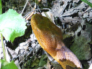
 Finally a Copperhead
 New Shoes: New Balance MT1010s, See "Transitioning to Minimal Shoes" post

A lake on the way across the park
 The view from the other side
 Don't know what kind of snake this is...
 First pair of New Balance MT110s biting the dust, cut on rocks
 Mohonk: Hiking the Crevice, aka "Lemon Squeeze"


 Slide Mountain from the Tower

 Trapps climbing area, with Millbrook ridge above
 Another Copperhead (baby) -- two in one week!

4:14 940 1:29 500 11:46 6175 16:00
This is that last week that I will be actively tracking and planning my runs on a weekly basis, and thus ends my more formal training plan for 2012. I will switch to a more free-format running and hiking style, and will blog about that in the near future. It's just time to try something new.
Some Photos from the week:
After seeing lots of Timber Rattlesnakes this year, RIGHT near this sign...


A lake on the way across the park


9/01/2012
Transitioning to Minimal Shoes
Over the past two years I've been transitioning toward more minimal shoes. This started with the Saucony line of lighter shoes: the Kinvara road shoes and the Peregrine trail shoes. In 2011 I ran mostly in Nike Skylons and Saucony Kinvaras on roads and easier trails, while I wore Montrail Mountain Masochists and Saucony Peregrines on tougher trails, but I never really liked the feel of the Peregrines much. The Peregrines felt harsh; I wasn't ready for them.
This year I've tried three models of New Balance Minimus, first the MT20, then the MT110, and most recently the new MT1010, but I've also changed my mind about the Saucony Peregrine.
Montrail Mountain Masochist, 12.5, 13.25 oz: While in 2011 I liked the feel of the Masochists, they now feel very bulky, and I don't like the greater heel-to-toe drop anymore, probably because I've been running so much in the MT110s, which have a 4mm drop. I rarely use the Masochists now.
Saucony Peregrine, 12.5, 11.5 oz: Recently I've discovered the Peregrines feel much better, especially for long runs over rocky terrain, so these are becoming my go-to shoes for long outings. They recently handled my Slide Mountain loop in the Catskills very well. Saucony came out with a second version of these shoes, which I may try at some point when I need more shoes.
New Balance MT1010, 12.5 EE, 9 oz: I just got these last week, and though New Balance puts them in the Minimus line of shoes, the feel is very different from the MT110 and MT20. They feel spongy and the fit is not nearly as low or secure as the MT110 or MT20. These actually remind me of the spongy feel of the Saucony Kinvara road shoes, or the Nike Lunarglide (which I returned). I really don't see how these belong in the Minimus line. The rock protection is no better than the MT110, and they are not as stable. I wore them for over 6 hours on two outings, and they were extremely comfortable. On the plus side, they have fantastic grip on rock even on angles greater than 45 degrees, and I didn't mind wearing them. I think after the foam gets compacted they will be much better shoes. Overall slightly disappointed with the MT1010, which I thought was going to be similar to the MT110, but suitable for longer distances.
New Balance MT110, 12.5 EE, 9.4 oz: The MT110 is a fantastic shoe in so many ways, and is the best trail shoe I've ever run in, by far. They feel like racing flats with some rock protection, have excellent feel, fit, control, balance, and are a joy to run in. I can't wait to try version 2 of these shoes. The drawbacks of the MT110 are they have minimal cushioning, but enough for long runs once you get used to them. They also protect against rocks much better the newer they are, but still hold up pretty well. The sole is split with rubber front and back and foam in the middle, so the middle wears faster. The upper could be sturdier, and sharp rocks cut into my first pair and shortened it's life. A work in progress, but a truly fantastic shoe.
New Balance MT20, 13, 8 oz: The MT20, also with the same 4mm heel-to-toe drop as the MT1010 and the MT110, have almost no cushioning, but have excellent feel and are very good shoes to help teach natural running form. I like to wear them on short outings to feel the ground, but I prefer the MT110s for most of my running. Surprisingly, despite these having a Vibram sole, the MT110s which don't have better grip, as do the MT1010s (which have a different Vibram sole).
Pictured left to right below: Mountain Masochist, Peregrine, MT1010, MT110 (2x), MT20


This year I've tried three models of New Balance Minimus, first the MT20, then the MT110, and most recently the new MT1010, but I've also changed my mind about the Saucony Peregrine.
Montrail Mountain Masochist, 12.5, 13.25 oz: While in 2011 I liked the feel of the Masochists, they now feel very bulky, and I don't like the greater heel-to-toe drop anymore, probably because I've been running so much in the MT110s, which have a 4mm drop. I rarely use the Masochists now.
Saucony Peregrine, 12.5, 11.5 oz: Recently I've discovered the Peregrines feel much better, especially for long runs over rocky terrain, so these are becoming my go-to shoes for long outings. They recently handled my Slide Mountain loop in the Catskills very well. Saucony came out with a second version of these shoes, which I may try at some point when I need more shoes.
New Balance MT1010, 12.5 EE, 9 oz: I just got these last week, and though New Balance puts them in the Minimus line of shoes, the feel is very different from the MT110 and MT20. They feel spongy and the fit is not nearly as low or secure as the MT110 or MT20. These actually remind me of the spongy feel of the Saucony Kinvara road shoes, or the Nike Lunarglide (which I returned). I really don't see how these belong in the Minimus line. The rock protection is no better than the MT110, and they are not as stable. I wore them for over 6 hours on two outings, and they were extremely comfortable. On the plus side, they have fantastic grip on rock even on angles greater than 45 degrees, and I didn't mind wearing them. I think after the foam gets compacted they will be much better shoes. Overall slightly disappointed with the MT1010, which I thought was going to be similar to the MT110, but suitable for longer distances.
New Balance MT110, 12.5 EE, 9.4 oz: The MT110 is a fantastic shoe in so many ways, and is the best trail shoe I've ever run in, by far. They feel like racing flats with some rock protection, have excellent feel, fit, control, balance, and are a joy to run in. I can't wait to try version 2 of these shoes. The drawbacks of the MT110 are they have minimal cushioning, but enough for long runs once you get used to them. They also protect against rocks much better the newer they are, but still hold up pretty well. The sole is split with rubber front and back and foam in the middle, so the middle wears faster. The upper could be sturdier, and sharp rocks cut into my first pair and shortened it's life. A work in progress, but a truly fantastic shoe.
New Balance MT20, 13, 8 oz: The MT20, also with the same 4mm heel-to-toe drop as the MT1010 and the MT110, have almost no cushioning, but have excellent feel and are very good shoes to help teach natural running form. I like to wear them on short outings to feel the ground, but I prefer the MT110s for most of my running. Surprisingly, despite these having a Vibram sole, the MT110s which don't have better grip, as do the MT1010s (which have a different Vibram sole).
Pictured left to right below: Mountain Masochist, Peregrine, MT1010, MT110 (2x), MT20


8/28/2012
Outdoor Week Ending 8/26/12
Run Rclimb Long Lclimb Hike Hclimb OnFeet
6:49 1960 2:33 800 10:36 3945 17:25
Good week, feeling pretty strong, but longing for cooler temps soon!
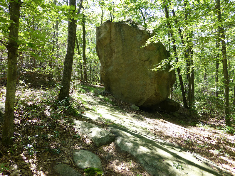
Some Pix -- Giant rock out on the breakneck ridge trail
 Third reservoir, just before I spooked 3 wild turkey coming around another big rock
 Despite lots of thunderstorms, water levels are low this year
 Looking east from Harriman park
 Zoom 20x to see a little bit of the Hudson River about 10 miles away
 This guy I'd seen before, out on the Suffern-Bear Mountain trail
 This time a female with a pretty golden color -- would have run into striking range but saw her...

I saw three timber rattlesnakes this week. The Ramapo highlands are loaded with them. Just makes you run more aware. I clap my hands sometimes when the trail has underbrush at the sides. Can't run with headphones really or you miss all those little sounds: chipmunks, skenks, snakes...
6:49 1960 2:33 800 10:36 3945 17:25
Good week, feeling pretty strong, but longing for cooler temps soon!
Some Pix -- Giant rock out on the breakneck ridge trail


I saw three timber rattlesnakes this week. The Ramapo highlands are loaded with them. Just makes you run more aware. I clap my hands sometimes when the trail has underbrush at the sides. Can't run with headphones really or you miss all those little sounds: chipmunks, skenks, snakes...
8/19/2012
Outdoor Week Ending 8/19/12
Feeling good this week. After the big run Thursday from Woodland Valley, Friday I ran a little but the left knee was slightly sore that night, so I was going to just hike Saturday, but took the day off instead. Feeling pretty good today out there the better part of 4 hours again. Did lots of very technical trails today and only felt a little sluggish.
Run Rclimb Long Lclimb Hike Hclimb OnFeet
7:54 2655 2:53 875 10:16 7055 18:10
13-Aug run 0:53 400 3.5 south harriman
13-Aug hike 2:17 700 2.5 south harriman
14-Aug run 1:11 600 3.5 ram park
14-Aug hike 1:44 700 3 ram park
15-Aug run 0:27 50 2.5 south harriman
15-Aug hike 1:05 480 2.5 south harriman
16-Aug run 2:53 875 5 Slide Loop
16-Aug hike 2:55 4225 5 Slide Loop
17-Aug run 0:27 30 2 ram park
17-Aug hike 0:38 350 2 ram park
18-Aug off
19-Aug run 2:03 700 3.5 south harriman
19-Aug hike 1:37 600 3.5 south harriman
Goals:
I'm still feeling like I will probably run the Vermont 50k (end of September) and maybe the Maine Bradbury SP 50k as well later in October. But instead of doing races, I might just do a big run every 3rd week like I've been doing all year, somewhere out on some cool trails. I feel like I'm making progress in my running and hiking and it's taking me to a new level, so I might just continue that. I'll decide soon.
Run Rclimb Long Lclimb Hike Hclimb OnFeet
7:54 2655 2:53 875 10:16 7055 18:10
13-Aug run 0:53 400 3.5 south harriman
13-Aug hike 2:17 700 2.5 south harriman
14-Aug run 1:11 600 3.5 ram park
14-Aug hike 1:44 700 3 ram park
15-Aug run 0:27 50 2.5 south harriman
15-Aug hike 1:05 480 2.5 south harriman
16-Aug run 2:53 875 5 Slide Loop
16-Aug hike 2:55 4225 5 Slide Loop
17-Aug run 0:27 30 2 ram park
17-Aug hike 0:38 350 2 ram park
18-Aug off
19-Aug run 2:03 700 3.5 south harriman
19-Aug hike 1:37 600 3.5 south harriman
Goals:
I'm still feeling like I will probably run the Vermont 50k (end of September) and maybe the Maine Bradbury SP 50k as well later in October. But instead of doing races, I might just do a big run every 3rd week like I've been doing all year, somewhere out on some cool trails. I feel like I'm making progress in my running and hiking and it's taking me to a new level, so I might just continue that. I'll decide soon.
8/17/2012
Catskills: Slide Mountain Loop
Just another run-hike up in the Catskills. Lots of fun. I parked in Woodland Valley, then headed up Wittenburg Mountain, then looping clockwise over Cornell and Slide, the high point in the Catskills, then around on the road a little to climb up onto a slight detour at Giant Ledge, backtracking and running back down into Woodland Valley. Some stats for the outing:
About 7 hours total time
Overall 5:37 moving time at heart rate 140 (73% max), 5100' climb/descent, about 17.5 miles
Hiking: 2:55, 4225' climb, 125' descent, HR 139, about 5.9 miles
Running: 2:53, 875' climb, 4925' descent, HR 141, about 11.6 miles
Basically most of it is very technical, and I ran where I could. Most of the uphills were too steep to run. Interesting (to me) how similar the heart rates are.
Gear: I chose the Saucony Peregrines, a lighter shoe, over the Montrails, and it worked out really good. My feet were comfortable the whole time and they handled the miles of rubble fine. I'd brought a very thin shell top, my headlamp, fire starting stuff, about 1000 Cal of food, and a little over a gallon of water. But I ran out of water with about 2 miles to go, and I'd run out of food before that. All the springs were dry on the main loop. Good thing it wasn't a hot day!

Trail to Wittenburg


Somewhere in here, about a third of the way up Wittenburg, I passed a group of a dozen mid-teenage backpackers. I didn't see anybody else until I got the col between Cornell and Slide.
 Views from Wittenburg, South
 East, the Ashoken Res, at least half a vertical mile below, very low water, huge sandbars visible
 North, the Devil's path range
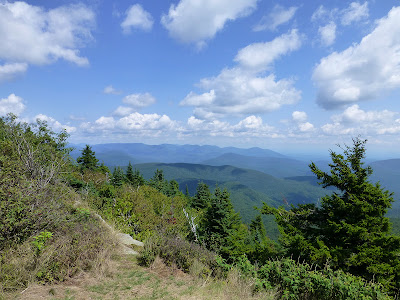
 North, looking back at Wittenburg from Cornell
 Camping spot atop Cornell
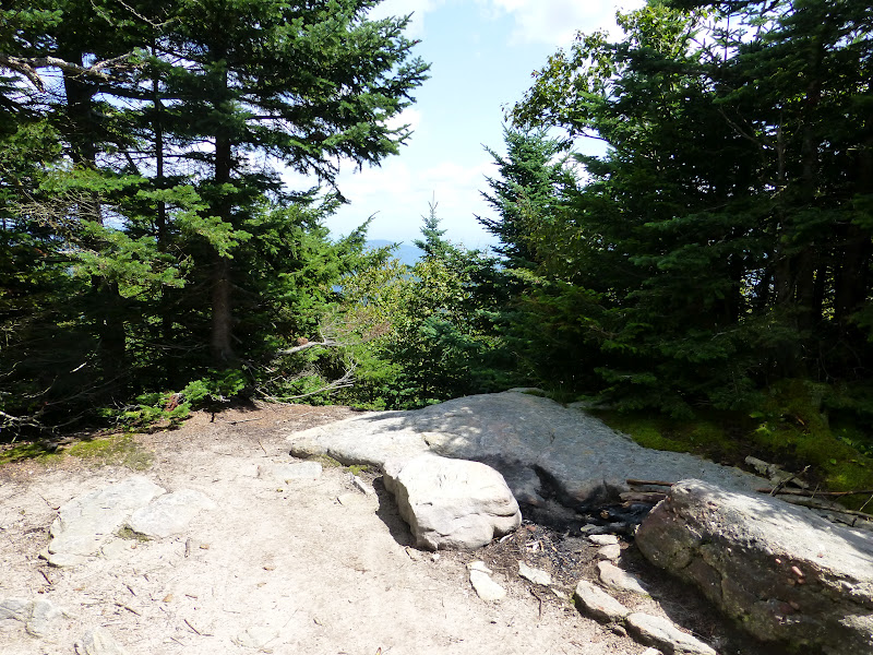
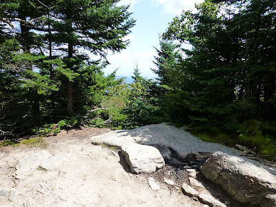 West from Cornell, Slide Mountain looming
 South, a glimpse of Rocky and Table mountains

In the col before Slide, I saw a couple of backpackers looking at the camping spots there (some nice ones). Then I met a solo backpacker heading down the steep side of Slide. He was looking for water but said the spring higher up was dry. The trail was really wet after lots of thunderstorms in this area (rocks really slippery, wet feet a bit) but the rains have been quick so we're starting to get drought conditions in some areas even though everything is lush on the surface. I told the guy that he might have to hunt south off the col for streams that become the headwaters of the Neversink river (east branch). I did that once when overnight-ing off-trail, just keep going downhill in the deepest gully you can find until water is flowing. Costly in terms of contours though, and not guaranteed.
The rubble trail down from Cornell
 Lots of very tough ledges between Cornell and Slide, many being more dangerous than anything on the Escarpment trail
 The steep side of Slide has some small cliffs you have to climb, and a bunch of ladders
 East, Wittenburg and Cornell from the slopes of Slide

 Top of Slide, All the good views are a bit down the hill

Up on top of Slide I started to see more people, four people on top already when I got there, then about half a dozen more on the descent to the main Slide parking area.
Heading down Slide to the west there is one great view to the north, this one looks down at Giant Ledge, where I'm headed next, and Panther mountain beyond
 Giant Ledge doesn't look like much from here, but it probably has the best easy-hike (from rt 47) views in the Catskills
 North still, Devil's path range again
 Heading west, the trail on top of Slide is fairly runnable at first
 Then it descends into worse and worse rubble, quite challenging stuff lower down
 Midway down, what does that look like 15%? Nasty rubble
 Camera held level, looking down the trail
 Same, looking up
 9.7 miles to go.
 Had to do a mile (?) on the road

 The Winnisook lodge private club in the saddle of the hill at 2700'


Just past the lake, where the road heads downhill is the easement, but the marked trail follows the road. Of course I took the easement, to save a whole bunch of contour lines.

Looks like the Winnisook lodge wanted a nice level trail over to Giant Ledge, but 95% of it is on public land, so I guess the compromise was it's fine for the public to use it (hence the easement over the short bit at the start), but in every other way discourage the public from using it, making the marked trail detour 700 vertical feet down to the road and put up sticks and stuff to discourage people.
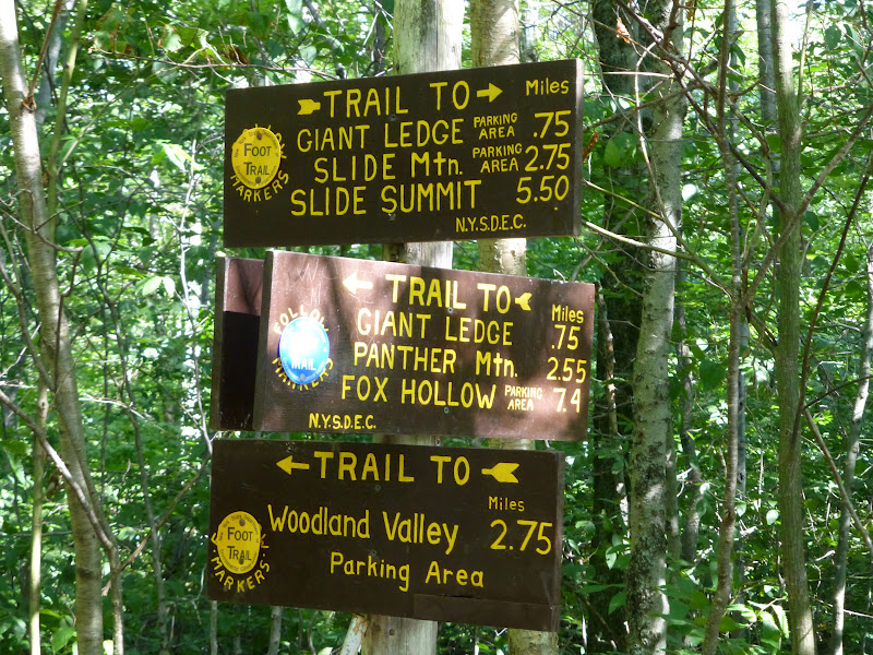
 About to detour 1.5 miles for the views at Giant Ledge
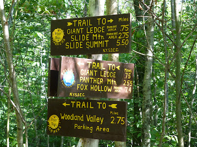 Which are here: North
 Southeast, the ridge around the Woodland valley basin I climbed and hiked/ran around


The trail back down to Woodland valley is full of rubble and is very technical because of that, but this photo doesn't really show it, oh well.

Halfway down the 2.7 miles to Woodland valley I saw the same group of teenagers I'd seen 6 hours earlier, now going uphill when I was coming down. They were kind of shocked I'd come all the way around when they'd only gone about 2 1/2 miles, and that I was running down the trail, which was full of nasty rubble (basically almost no dirt and several levels of smaller unstable rocks). I thought at the time: backpacking is fun sometimes but I'm happy to be heading home.
After I saw those disheartened kids (they had a good 1200' to climb, preferably before dark and it was already almost 6pm, that side of the valley already in shadow), the one group higher up waiting for 3 girls dragging far behind -- I was happily scooting down the rocks as efficiently as I could, and then the trail suddenly turns left at the bottom of a huge reentrant, and starts going straight back up the mountain at a 40 to 45 degree slope, the trail markers stretching on up the hill out of sight. Ok I'm thinking, I was having fun cruising, what the hell?! That got me to get the map out, so checking, I see the big square corner of private land jutting deep into the park from the valley road. Got it. But, you know, I'd been out of water for 45 minutes by then, with still a tough 1.x to go, so I didn't relish climbing those 250 vertical feet just then, but that's the trail. Somehow I'd forgotten that little bit after I last did this stretch of trail almost 20 years ago. Oh I was going the other way, that's why.
Done

I changed the total length estimate to 17.5 miles. The 16 miles the trail map specifies for the whole loop, + the 1.5 mile GL detour, - 0.5 the savings of the easement, + 0.5, the little bit running down the wrong trail (cruising having a good time); well someone had stolen the trail markers at the turn.
Not that miles really matter much on these kind of trails. I just look at the map and based on experience and some knowledge of the terrain make an educated guess on how long the whole thing will take me. This time I had guessed I could do it in about 5 hours moving time, running and hiking. I always like to stop for 5 minutes here, 10 minutes there, and always longer at some point. So the overall time was 7 hours, more important to me is moving time. So this time was 5:47 moving time, about evenly divided between hiking and running. No leisurely hiking this time, just pushing steadily up 4k+ of climb. Not having done some of these trails in 20 years I'd forgotten how technical the footing is and the rocks were really wet in many places, so I wasn't taking chances.
I never ran this loop before, but hiked it 19 years ago, and have run various little parts of it since then. "Running" this loop intimidated me a little in the past. I would do pretty big stuff (for me) in the Catskills, like a 27 mile loop on all new (but easier) trails to me over near Mongaup pond, but I didn't think of running this Slide loop until a few days before. I think the difference now is how much more hiking I've been doing this year as I've extended my outings that used to be pretty much all trail runs. Now I go out with the intent to hike part of the time and run part of the time, and that gives me confidence to not only handle a bit longer stuff on a daily basis, but a go-as-you-please approach makes the outing more enjoyable. In this case though I did run everything I could; the terrain dictated that I hike fully half of it time-wise, one third by mileage.
About 7 hours total time
Overall 5:37 moving time at heart rate 140 (73% max), 5100' climb/descent, about 17.5 miles
Hiking: 2:55, 4225' climb, 125' descent, HR 139, about 5.9 miles
Running: 2:53, 875' climb, 4925' descent, HR 141, about 11.6 miles
Basically most of it is very technical, and I ran where I could. Most of the uphills were too steep to run. Interesting (to me) how similar the heart rates are.
Gear: I chose the Saucony Peregrines, a lighter shoe, over the Montrails, and it worked out really good. My feet were comfortable the whole time and they handled the miles of rubble fine. I'd brought a very thin shell top, my headlamp, fire starting stuff, about 1000 Cal of food, and a little over a gallon of water. But I ran out of water with about 2 miles to go, and I'd run out of food before that. All the springs were dry on the main loop. Good thing it wasn't a hot day!

Trail to Wittenburg


Somewhere in here, about a third of the way up Wittenburg, I passed a group of a dozen mid-teenage backpackers. I didn't see anybody else until I got the col between Cornell and Slide.




In the col before Slide, I saw a couple of backpackers looking at the camping spots there (some nice ones). Then I met a solo backpacker heading down the steep side of Slide. He was looking for water but said the spring higher up was dry. The trail was really wet after lots of thunderstorms in this area (rocks really slippery, wet feet a bit) but the rains have been quick so we're starting to get drought conditions in some areas even though everything is lush on the surface. I told the guy that he might have to hunt south off the col for streams that become the headwaters of the Neversink river (east branch). I did that once when overnight-ing off-trail, just keep going downhill in the deepest gully you can find until water is flowing. Costly in terms of contours though, and not guaranteed.
The rubble trail down from Cornell


Up on top of Slide I started to see more people, four people on top already when I got there, then about half a dozen more on the descent to the main Slide parking area.
Heading down Slide to the west there is one great view to the north, this one looks down at Giant Ledge, where I'm headed next, and Panther mountain beyond


Just past the lake, where the road heads downhill is the easement, but the marked trail follows the road. Of course I took the easement, to save a whole bunch of contour lines.

Looks like the Winnisook lodge wanted a nice level trail over to Giant Ledge, but 95% of it is on public land, so I guess the compromise was it's fine for the public to use it (hence the easement over the short bit at the start), but in every other way discourage the public from using it, making the marked trail detour 700 vertical feet down to the road and put up sticks and stuff to discourage people.



The trail back down to Woodland valley is full of rubble and is very technical because of that, but this photo doesn't really show it, oh well.

Halfway down the 2.7 miles to Woodland valley I saw the same group of teenagers I'd seen 6 hours earlier, now going uphill when I was coming down. They were kind of shocked I'd come all the way around when they'd only gone about 2 1/2 miles, and that I was running down the trail, which was full of nasty rubble (basically almost no dirt and several levels of smaller unstable rocks). I thought at the time: backpacking is fun sometimes but I'm happy to be heading home.
After I saw those disheartened kids (they had a good 1200' to climb, preferably before dark and it was already almost 6pm, that side of the valley already in shadow), the one group higher up waiting for 3 girls dragging far behind -- I was happily scooting down the rocks as efficiently as I could, and then the trail suddenly turns left at the bottom of a huge reentrant, and starts going straight back up the mountain at a 40 to 45 degree slope, the trail markers stretching on up the hill out of sight. Ok I'm thinking, I was having fun cruising, what the hell?! That got me to get the map out, so checking, I see the big square corner of private land jutting deep into the park from the valley road. Got it. But, you know, I'd been out of water for 45 minutes by then, with still a tough 1.x to go, so I didn't relish climbing those 250 vertical feet just then, but that's the trail. Somehow I'd forgotten that little bit after I last did this stretch of trail almost 20 years ago. Oh I was going the other way, that's why.
Done

I changed the total length estimate to 17.5 miles. The 16 miles the trail map specifies for the whole loop, + the 1.5 mile GL detour, - 0.5 the savings of the easement, + 0.5, the little bit running down the wrong trail (cruising having a good time); well someone had stolen the trail markers at the turn.
Not that miles really matter much on these kind of trails. I just look at the map and based on experience and some knowledge of the terrain make an educated guess on how long the whole thing will take me. This time I had guessed I could do it in about 5 hours moving time, running and hiking. I always like to stop for 5 minutes here, 10 minutes there, and always longer at some point. So the overall time was 7 hours, more important to me is moving time. So this time was 5:47 moving time, about evenly divided between hiking and running. No leisurely hiking this time, just pushing steadily up 4k+ of climb. Not having done some of these trails in 20 years I'd forgotten how technical the footing is and the rocks were really wet in many places, so I wasn't taking chances.
I never ran this loop before, but hiked it 19 years ago, and have run various little parts of it since then. "Running" this loop intimidated me a little in the past. I would do pretty big stuff (for me) in the Catskills, like a 27 mile loop on all new (but easier) trails to me over near Mongaup pond, but I didn't think of running this Slide loop until a few days before. I think the difference now is how much more hiking I've been doing this year as I've extended my outings that used to be pretty much all trail runs. Now I go out with the intent to hike part of the time and run part of the time, and that gives me confidence to not only handle a bit longer stuff on a daily basis, but a go-as-you-please approach makes the outing more enjoyable. In this case though I did run everything I could; the terrain dictated that I hike fully half of it time-wise, one third by mileage.
Subscribe to:
Posts (Atom)